
Trace a McKinney Street from Address to Record
A street-by-street search works best as an evidence chain, not as a list of people. The City of McKinney map establishes where an address point and parcel sit. The Collin County Appraisal District, commonly called CCAD, supplies the current tax-account identifiers and displayed owner or mailing fields. Those identifiers make the County Clerk index more precise, while a dated directory or voter record may be a separate, time-limited address mention. Keep the source date beside every result. An owner, a mail recipient, a voter registrant, a permit contact, and an occupant can be different people.
- Preserve the address exactly as it appeared, including directional letter, suffix, unit, postal city, and date on the source.
- Find the location in the City Addresses and Boundaries service, then note the address point, parcel, ZIP, city-limit, and ETJ context.
- Search the same address in CCAD Property Search and retain its property ID, geographic ID, situs address, mailing address, tax year, legal description, and deed reference where shown.
- Use the legal description, subdivision, lot, block, document number, or party name in the Collin County Official Records advanced search to inspect the deed trail.
- For an older address, compare a directory street page, newspaper or map evidence, and record any gap rather than filling it with a guess.
Read the City GIS Layers Before Naming a Street Segment
The city’s Addresses and Boundaries MapServer separates several kinds of geography. Layer 0 is Address and layer 1 is Parcel. Layer 5 is ZIP Codes, layer 6 is City Limits, and layer 7 is ETJ. These layers can establish the mapped place, including whether a point is within city limits or the extra-territorial jurisdiction, but they do not establish current occupancy or a social relationship between nearby parcels. A broad service query also has a 2,000-record maximum, so targeted searches are preferable to trying to download an entire street or city layer.
Begin with an address point and the parcel polygon that contains it. Check the nearby geometry visually, especially around alleys, frontage roads, cul-de-sacs, and split lots. Then copy only the parcel identifier needed for the next step. A ZIP is a delivery area and can cross city, precinct, school, or neighborhood lines. If a mapped result has a McKinney postal address but lies in ETJ or county context, describe that distinction rather than silently calling it a city address.
The City Code Services GIS layer is another place-focused layer. Its visible fields include CaseNumber, CaseType, Status, OpenDate, CloseDate, Address, and Parcel. Search or filter by a number, project, address, type, or status as available. A case point can document that a municipal record exists, but some detail requires a CSS account and it is not a household roster.
See the City Code Services map layer used for address-based case context.
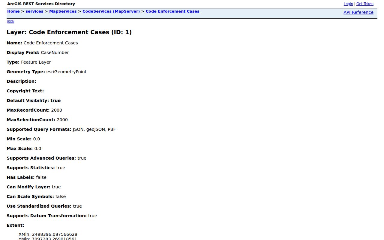
Use the field labels as a checklist, then follow the case number or status through the appropriate city route instead of assuming that a point identifies a person at the address.
Use CCAD Fields to Narrow a McKinney Street Search
CCAD is the practical current starting point because it turns a familiar street address into stable parcel and legal-description clues. Its search screen offers By Owner and Advanced tabs. The site’s own hints recommend simplifying a street to its name and omitting a suffix, prefix, or unit when a full address does not return a card. That is a search tactic, not a reason to discard the full form from the research note. Keep both forms so an older directory, postal record, or deed can be compared fairly.
| CCAD search field | How it helps with a street | What to retain from a result |
|---|---|---|
| Owner name | Offers a current tax-account entry when an address search is unclear. | Displayed owner field and result date, not an occupancy conclusion. |
| Street number and street name | Locates a specific address or a simplified street search. | Normalized and original address forms. |
| Property ID and geographic ID | Connect the account to parcel and map work. | Both IDs with the tax year. |
| Property type, subdivision, neighborhood | Helps distinguish similar street names or locate a lot area. | The matching subdivision or neighborhood label. |
| Tax year and legal description | Sets the account snapshot and creates the bridge to recorded land instruments. | Legal description and deed references for clerk verification. |
A current card can display owner and mailing values, situs address, legal description, deed references, appraisal details, exemptions, inspection date, and tax-year information. The district cautions that its data is for research and that legal descriptions and acreage need verification for legal use. A record may not expose every field from CCAD’s data layout, so describe the card that was actually inspected rather than promising a fixed set of results.
Practical step Let the Legal Description Bridge Old and New Streets
A literal address is fragile. Street renumbering, a renamed road, annexation, a new subdivision, a changed ZIP, or a parcel split can make a direct address search look empty. The legal description, often built from subdivision, lot, block, tract, or metes-and-bounds language, is the stronger bridge. The City of McKinney’s How to Research Your House guide directs researchers to obtain it from CCAD and use it for the County Clerk title chain rather than relying on the street address alone.
In the County Clerk’s quick search, try an owner, grantor, grantee, document number, subdivision, or legal description, then separate recorded-date searches from instrument-date searches. The advanced search adds fields for party, grantor/grantee, notary, instrument date, book/page, and legal description. For a common name, pair a limited date range with the subdivision or lot-and-block wording. Open a plausible hit and compare its legal description, parties, execution and acknowledgment, recording stamp, instrument type, and redactions against the CCAD card.
The County Clerk’s Historical Records route covers 1843 through 1975. The online database is not the official repository, and the county cautions that it may be incomplete or may not show an unaltered document. When a document matters, verify it through the County Clerk or obtain the appropriate official copy. Record whether the result was an index hit, an unofficial image, or a clerk-verified instrument.
See the County Clerk’s advanced official-record search before choosing the fields that match the parcel.
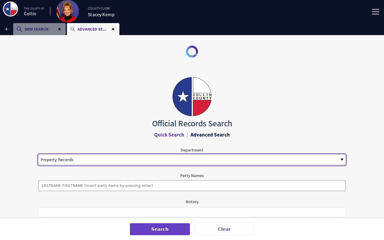
The advanced form is most useful after CCAD supplies an ID or legal-description clue, because that sequence avoids treating a broad surname result as a title chain.
McKinney Street Directory Records and Their Different Meanings
One address can appear in records held by different custodians, but the common street line does not turn those records into the same fact. The table keeps the source role separate. It also shows why a source date is essential: a current appraisal card, a recorded instrument, a city case, and a printed directory were created on different schedules and for different purposes.
| Address-keyed source | Custodian | What it can show | Useful limit |
|---|---|---|---|
| Address and parcel GIS | City of McKinney | Mapped address, parcel geometry, ZIP, city limits, ETJ, and nearby parcels. | Geography, not a list of people. |
| Property account | Collin County Appraisal District | Displayed owner, mailing and situs fields, legal description, IDs, tax year, and deed references. | Ownership and mailing are not proof of presence. |
| Official land-record index | Collin County Clerk | Grantor/grantee, instrument type and date, document number, and legal-description trail. | Online index is not the official repository. |
| City code or permit context | City of McKinney | Address or parcel-linked case fields, and permit status where access permits. | Account requirements and field meaning apply. |
| Historic directories and maps | Library, UNT, and map repositories | Dated street order, historical address mentions, and structure context. | Each edition or map is a snapshot, not continuous occupancy. |
For a street segment, start with the GIS address and parcel, move the CCAD property and geographic IDs into the land-record search, and then compare legal-description language. If the map shows a code point, carry its CaseNumber and Status into city research. Do not merge a permit applicant, deed party, or current tax-account owner into one identity without supporting, dated evidence.
Check City Case and Permit Context by Address
City records can place an administrative event at a parcel or address, which is useful for understanding a property timeline. The CSS portal is account-based, and filters or detailed history may be available only after the relevant account access. Preserve the record’s own label, whether it is a permit, inspection, project, case, or status. A name or contact attached to one municipal field has the meaning assigned by that system, not a blanket description of everyone associated with the address.
The City’s code-services material also warns about bogus permit invoices. Verify a fee request through an official mckinneytexas.org or egov.mckinneytexas.org route and do not use a message alone as proof that a city case or application exists.
View the account entry point at the McKinney CSS portal.
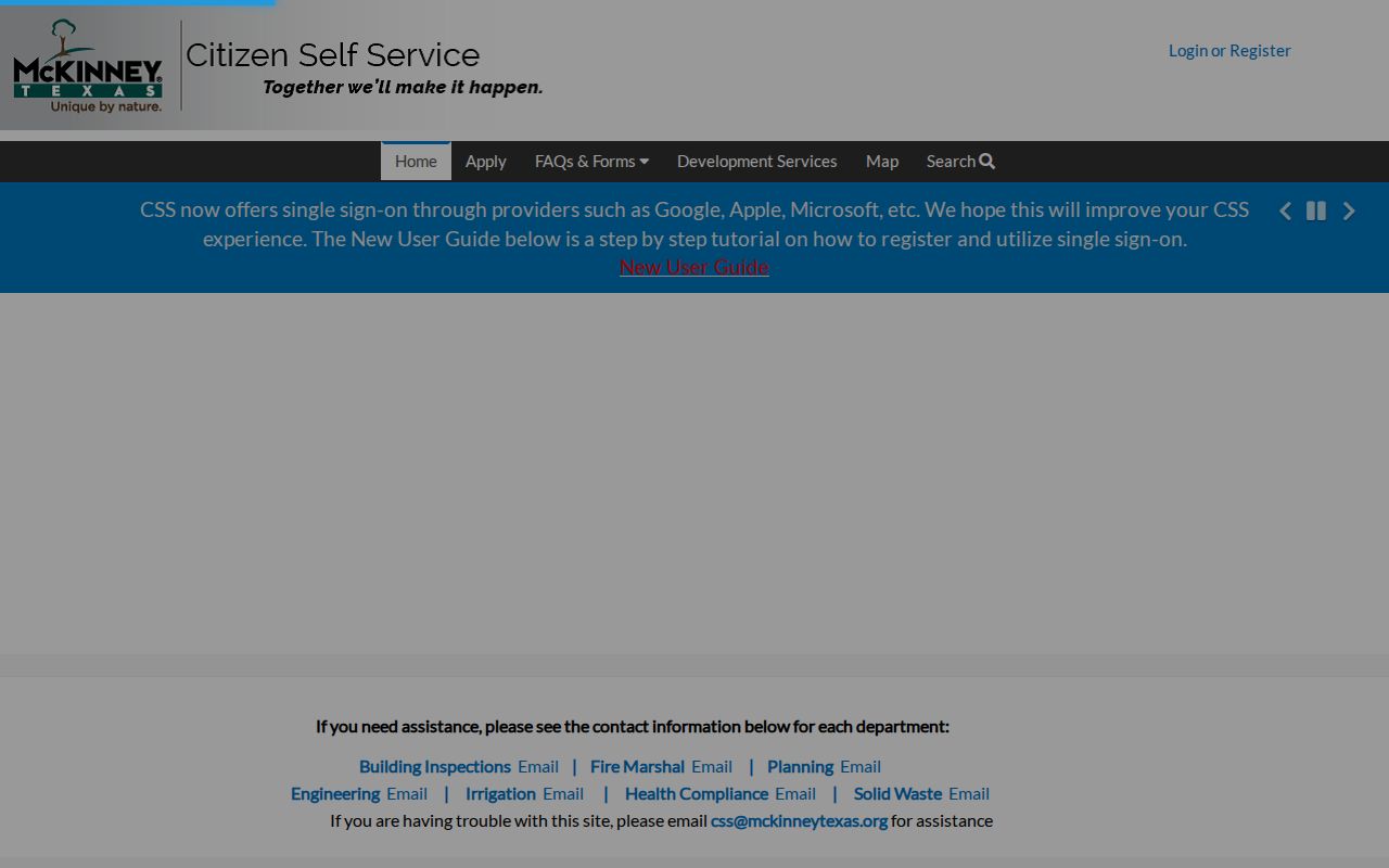
Use a map or account result to record a case number, type, status, and source date, then keep that place evidence separate from person-related research.
Use Historic Street Pages in the McKinney Street Directory
When the question is historical, the local directory collection supplies an address-order view that current portals do not. The inspected 1933 McKinney street-address page includes a NORTH COLLEGE STREET heading, house numbers, names, intersections, and old marks. It is a dated publication, not proof of a continuing connection to that address. Search the printed street form and a normalized form, then inspect the directory key before interpreting abbreviations such as “o/r” or “h/r.”
For a stronger chronology, compare two directory years before calling an address stable. The 1938 directory has alphabetical name evidence, while later McKinney collections include 1953, 1960, 1968, 1971, and 1977 runs. The city’s genealogy resources, newspapers, census and tax materials, Sanborn maps, and the County Clerk deed chain can each corroborate a small portion of the story. Cite the edition, page, repository, and whether a human inspected the scan rather than relying on an OCR result alone.
Sanborn maps answer what stood at a place on a map date, not who lived there. The 1888 McKinney map has four sheets, and the 1892 map adds footprints, materials, house or block numbers, and related context. When a modern parcel covers old lots, align the historic grid with the current GIS and explain any uncertainty.
Keep McKinney Address Terms Separate
Parcel: a mapped unit of land used in the appraisal and GIS systems. Situs address: the taxable location shown for an account. Plat: a recorded map that can create or alter lot geometry. Criss-cross directory: an address-ordered historical directory that can be checked alongside a name-ordered edition.
A mailing address receives notices; a voter residence field supports registration; a postal city and ZIP serve delivery; city limits and ETJ describe municipal geography; and a legal description identifies land. CCAD itself separates mailing fields from situs fields. These distinctions matter on the edge of McKinney, where postal labels, city limits, and county parcel context need not match. The city ZIP map places 75454 in McKinney and ETJ context, while the county map associates it with Melissa, so it must be checked as a postal and municipal edge case. Treat each field as written and record the source date.
Record boundary A Listed Owner Is Not Automatically the Resident
CCAD ownership, a tax mailing address, a deed party, a permit contact, a voter record, and a directory entry are separate facts with separate dates. A current ownership field can establish that a tax account identifies an owner, but it cannot establish who is at an address today. A historical directory can place a printed name on a street in one edition, but it cannot fill a gap before or after publication. The safest street-directory result states the record type and date, then leaves an unsupported connection unresolved.
This distinction is also useful when CCAD and a deed do not match. Check whether the tax year differs, whether the parcel was split or recombined, and whether the legal description changed. A deed reference can be a better route into the clerk index than a broad person-name search. If records conflict, document the disagreement and consult the custodian rather than choosing a version because it is more recent-looking.
Limits and Lawful Use for the McKinney Street Directory
Address research has firm limits. Texas public-information exceptions protect categories of sensitive data, and the Address Confidentiality Program keeps qualifying participants’ actual residences out of ordinary county voter handling. Texas motor-vehicle personal information is restricted under the DPPA and Texas Transportation Code Chapter 730. Do not copy a protected detail from an image, try to bypass a suppression, or use a parcel result to make an occupancy claim. The County Clerk also notes the special status of its online database and the need to verify an important instrument with the official custodian.
Lawful use. Use McKinney street and parcel records for personal research, family-history work, civic curiosity, and checking a source with its custodian. Do not use a record to stalk, harass, threaten, or harm another person.